Latam Map PowerPoint Template
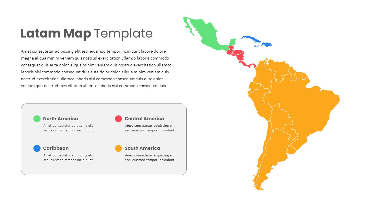
Visually segment Latin America into its four major regions with this clean, editable map slide. The right half displays a vector map of Latin America, with North America in green, Central America in red, the Caribbean in blue, and South America in orange—each region clearly outlined for emphasis. On the left, a concise text block allows you to introduce your topic or dataset, while a rounded‐corner legend card below pairs color swatches with region names and brief descriptions. Built on master slides for both PowerPoint and Google Slides, every element is fully customizable: swap colors via the theme palette, update the map boundaries, or replace text in seconds using drag-and-drop placeholders. The minimalist white background and subtle gray card border keep focus on your data, and alignment guides ensure pixel-perfect spacing.
Leverage slide transition presets to animate the map regions or legend entries in sequence, guiding your audience through market analyses, sales territories, or regional performance reviews. Whether you’re presenting to executives, clients, or classroom attendees, this layout delivers a professional, on-brand visual that simplifies complex geographic information.
Who is it for
Market analysts, sales managers, and business strategists will use this slide to illustrate territorial coverage, regional sales data, or distribution networks across Latin America. Consultants and educators can also leverage the map to teach geography, demographic trends, or cross-border initiatives.
Other Uses
Beyond geographic breakdowns, repurpose this template for highlighting regional KPIs, supply chain routes, service footprints, or localization strategies. The same map layout can also support environmental impact assessments, tourism overviews, and cultural studies.
Login to download this file


