Geographic Information System (GIS) template for PowerPoint & Google Slides


Description
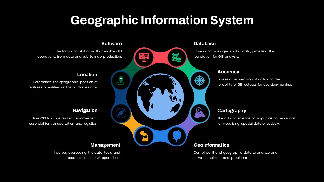
This Geographic Information System (GIS) Overview template offers a visually engaging way to present the various components of GIS, which include software, location, navigation, database, accuracy, cartography, and geoinformatics. Each component is represented in a vibrant, color-coded segment around a central globe, symbolizing the interconnected nature of GIS elements.
The design ensures clarity by organizing these segments in a circular format, highlighting their importance in the GIS process. From the tools that enable GIS operations (Software) to the process of analyzing geographic data (Geoinformatics), each element is accompanied by an icon and a brief description, making complex GIS concepts easy to understand for any audience.
Perfect for presentations in education, business, or technology, this template provides an ideal structure to explain GIS to students, stakeholders, or potential clients. Its clean, modern style is easy to customize, ensuring it aligns with your specific needs and is ready for use in both PowerPoint and Google Slides.
Who is it for
This template is ideal for GIS professionals, geographers, data analysts, educators, and business professionals who need to explain or present GIS concepts. It is also perfect for technology consultants and anyone introducing GIS solutions to clients or stakeholders.
Other Uses
In addition to explaining GIS systems, this template can be adapted for topics related to geographic data analysis, spatial planning, or map-making. It is also useful for demonstrating the applications of GIS technology in fields such as urban planning, logistics, and environmental science.
Login to download this file

Item ID
SB04539
Related Templates

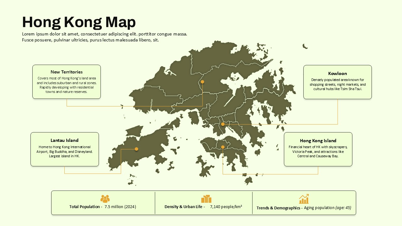
Hong Kong Geographic Map Infographic Template for PowerPoint & Google Slides
World Maps
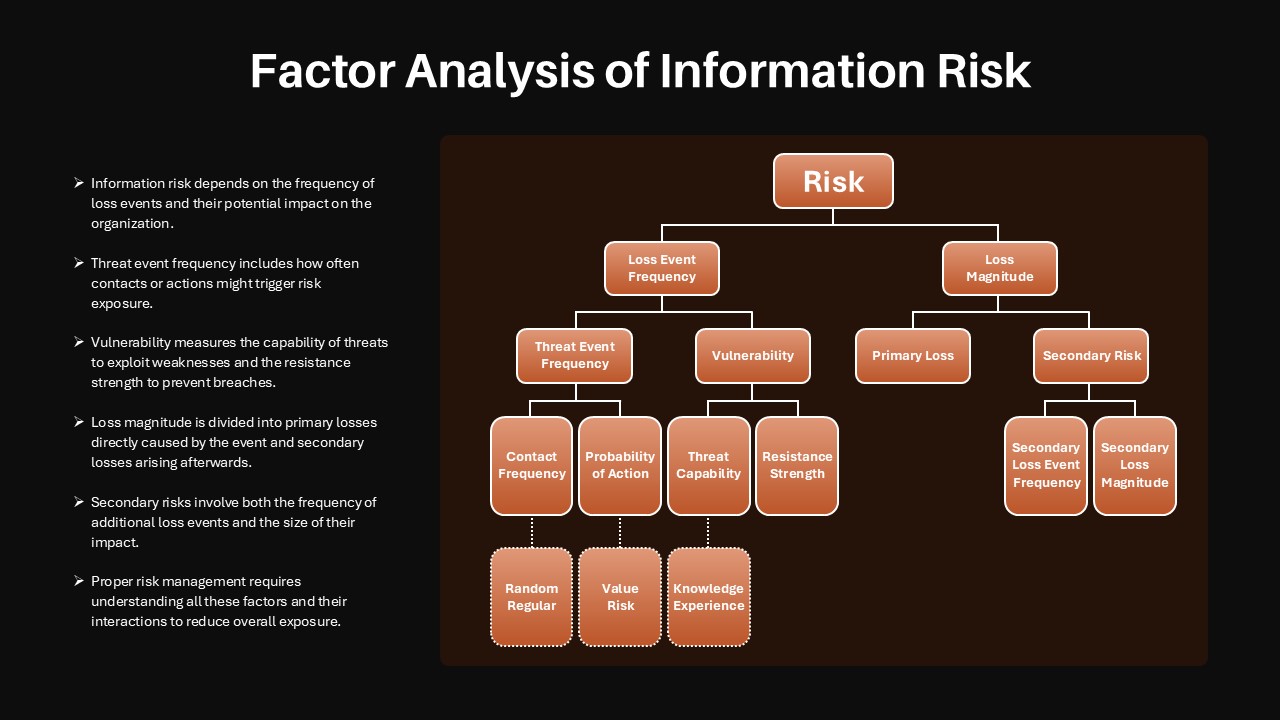
Factor Analysis of Information Risk Template for PowerPoint & Google Slides
Risk Management
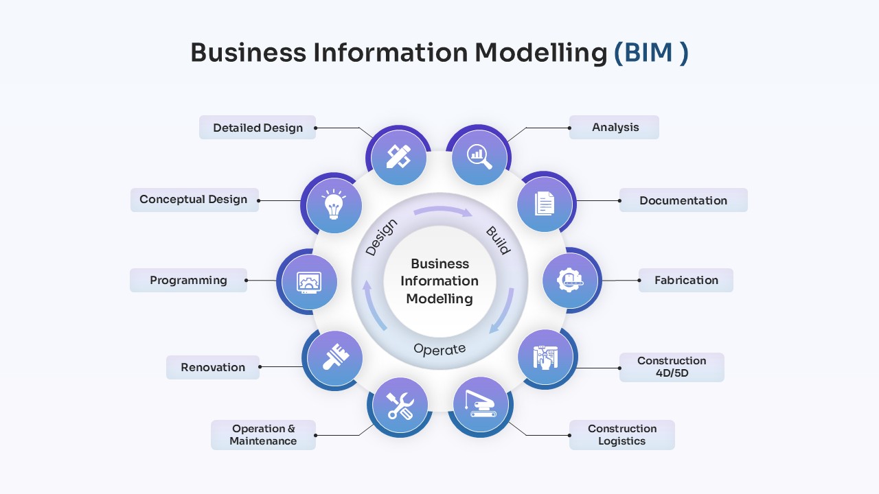
Business Information Modelling Process Template for PowerPoint & Google Slides
Process
Information Technology Overview Deck Template for PowerPoint & Google Slides
Information Technology
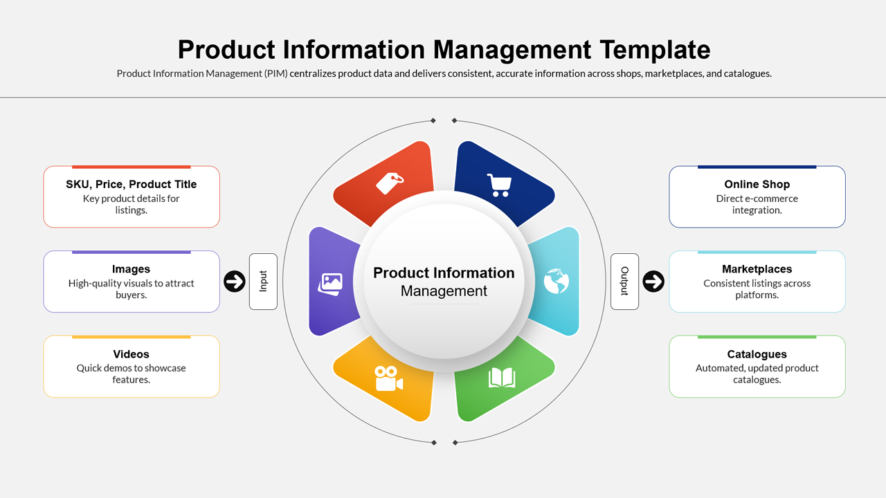
Product Information Management System Template for PowerPoint & Google Slides
Information Technology